Waterproof Jacksonville and St. Johns River Navigation Chart 37
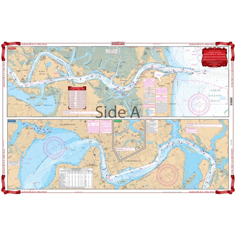
Lower St. Johns RiverStarting at the Atlantic Ocean, this chart covers up the St. Johns River to city of Jacksonville, continuing upstream through Green Cove Springs, Palatka, covering Murphy and Dunn Creeks and includes all of Crescent Lake.
Category: Nav Charts
Lower St. Johns River
Starting at the Atlantic Ocean, this chart covers up the St. Johns River to city of Jacksonville, continuing upstream through Green Cove Springs, Palatka, covering Murphy and Dunn Creeks and includes all of Crescent Lake.
Reviews
There are no reviews yet.