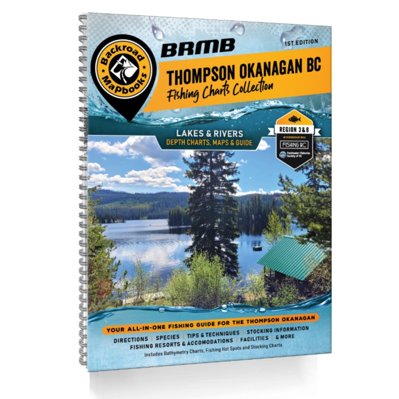
THOMPSON OKANAGAN BC FISHING – 1ST EDITION FISHING MAPBOOKS
Pages:224Dimensions:21.5 cm x 28 cm (8.5" x 11")Maps:210+ Lake Charts and River Maps of various scalesMap Features:Bathymetric Lake Depth Charts, Lake Data including Elevation, Surface Area, Maximum & Mean Depth, Stocking Information, Facilities, Highways,
Pages:224
Dimensions:21.5 cm x 28 cm (8.5″ x 11″)
Maps:210+ Lake Charts and River Maps of various scales
Map Features:Bathymetric Lake Depth Charts, Lake Data including Elevation, Surface Area, Maximum & Mean Depth, Stocking Information, Facilities, Highways, Logging and Industry Access Roads, Land & Water Features, Parks & Rec Sites, Boat Launches, Campgrounds, Fishing
Areas Covered:Clearwater, Grand Forks, Hope, Kamloops, Kelowna, Lake Country, Merritt, Okanagan Falls, Osoyoos, Peachland, Penticton, Princeton, Revelstoke, Sicamous, Tulameen, Vernon, & more
![ColemanPerfectFlow InstaStart Fold N Go Stove – 2-Burner [2000038018]](https://www.supportinge.com/wp-content/uploads/2026/4/1776237689/colemanperfectflow-instastart-fold-n-go-stove-2-burner-2000038018-1776237692.webp)
![Coleman Big Tall Quad Camping Chair – Grey [2178363]](https://www.supportinge.com/wp-content/uploads/2026/4/1776237659/coleman-big-tall-quad-camping-chair-grey-2178363-1776237663.webp)
![Coleman Fold N Go Propane Camping Stove – Black [2157592]](https://www.supportinge.com/wp-content/uploads/2026/4/1776237689/coleman-fold-n-go-propane-camping-stove-black-2157592-1776237692.webp)
![Coleman Forester Series Sling Chair – Grey [2149985]](https://www.supportinge.com/wp-content/uploads/2026/4/1776237607/coleman-forester-series-sling-chair-grey-2149985-1776237611.webp)
Reviews
There are no reviews yet.