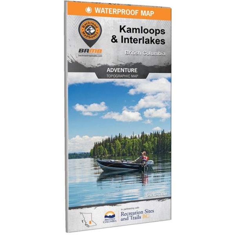
BRMB Kamloops & Interlakes BC Waterproof Map
A practical and easy-to-read map for exploring the forests and lakes around Kamloops and beyond. Includes recreation areas around 100 Mile House, Lone Butte, Bridge Lake, Little Fort, Cache Creek, Ashcroft, Savona, Heffley Creek, Logan Lake, and Lac le Jeu
Category: Camping
A practical and easy-to-read map for exploring the forests and lakes around Kamloops and beyond. Includes recreation areas around 100 Mile House, Lone Butte, Bridge Lake, Little Fort, Cache Creek, Ashcroft, Savona, Heffley Creek, Logan Lake, and Lac le Jeune. Trail systems, campsites, canoe routes, and access points are all marked, and it’s waterproof and tear-resistant to handle being stuffed in your pack. Map is at a scale of 1:150,000 with topographic and relief shading.
Tech specs
ShowTech specs
| Ideal for | Canoeing |
|---|---|
| Regionality | British Columbia |
| Language | English |
| Scale | 1:150,000 |
| Tearproof | Yes |
| Waterproof | Yes |
| Made in | Canada |
![ColemanPerfectFlow InstaStart Fold N Go Stove – 2-Burner [2000038018]](https://www.supportinge.com/wp-content/uploads/2026/4/1776237689/colemanperfectflow-instastart-fold-n-go-stove-2-burner-2000038018-1776237692.webp)
![Coleman Stadium Seat – Black [2000020268]](https://www.supportinge.com/wp-content/uploads/2026/4/1776237612/coleman-stadium-seat-black-2000020268-1776237615.webp)
Reviews
There are no reviews yet.