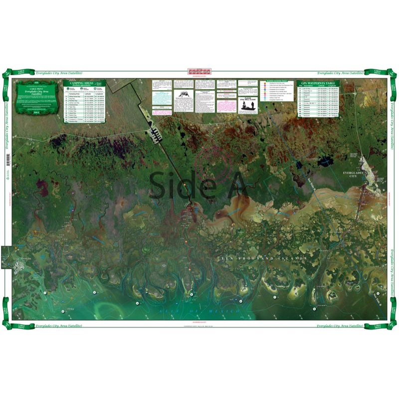
Everglades City Area Large Print Navigation Chart 40E
Detailed coverage of the 10,000 Islands area from Tripod Key to Chatham Bend. Includes Coon Key, Dismal Key, Port of the Islands and all the waterways south of Route 41. Compiled from NOAA charts and USGS Pictomaps this chart features canoe trails, inside
Category: LG Print
Detailed coverage of the 10,000 Islands area from Tripod Key to Chatham Bend. Includes Coon Key, Dismal Key, Port of the Islands and all the waterways south of Route 41. Compiled from NOAA charts and USGS Pictomaps this chart features canoe trails, inside small boat routes, updated beaches and campgrounds, GPS Waypoints and important areas of recent shoaling. Get the most out of your boating adventures around Everglades City with this navigation map.
Reviews
There are no reviews yet.