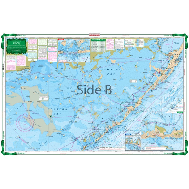
Florida Bay Large Print Navigation Chart 33E Map
Large Print Charts Florida BayThe most detailed and complete coverage of the Everglades National Park area from Key Largo to Flamingo and South to Marathon. This excellent guide to the Backcountry details marked cuts and channels, areas of recently reporte
Large Print Charts Florida Bay
The most detailed and complete coverage of the Everglades National Park area from Key Largo to Flamingo and South to Marathon. This excellent guide to the Backcountry details marked cuts and channels, areas of recently reported shoaling, areas open to day use and camping, as well as closed and restricted areas. Contains 39 sets of GPS Waypoints make it easy to set up your electronics. Compass courses from basin to basin and added information on location of water monitoring stations aid both the first time and the experienced explorer.
Reviews
There are no reviews yet.