Waterproof Charts Clearwater Beach to Egmont Key Large Print Navigation Chart 31E Map
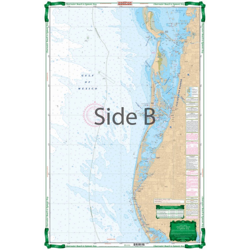
Large Print Charts Clearwater Harbor to Egmont KeyShows detailed Intracoastal Waterways area from Egmont Key to Sunshine Skyway and North to Clearwater Harbor and Honeymoon Island. Large Print Place Names make areas and inlets easy to find. A total of 15 G
Large Print Charts Clearwater Harbor to Egmont Key
Shows detailed Intracoastal Waterways area from Egmont Key to Sunshine Skyway and North to Clearwater Harbor and Honeymoon Island. Large Print Place Names make areas and inlets easy to find. A total of 15 GPS Waypoints. Covers area From 3 to 6 Miles Offshore as well. You may regret having bought your fancy GPS unit, but youll never regret this Clearwater nautical chart. This chart shows detailed intracoastal waterways area from Egmont Key to Sunshine Skyway and North to Clearwater Harbor and Honeymoon Island.
Reviews
There are no reviews yet.